


The first travelers or temporary residents we hear about are the Cheyennes, Arapahos, and the Utes. However, people have dwelt in the Americas for at least 22,000 years and some would take that figure back to 135,000 years. So, who really knows?
Here’s what we do know. The first entry for homesteaders probably came from North Cheyenne Canyon on the South side of Pike’s Peak, because the Mt. Cutler Trail, also known as Danieal’s Pass, likely preceded any land ownership by whites in the Sweetwater Canyon area of what became known as Greenwood Park.
That trail may have previously been used for logging, or perhaps, for shepherds taking sheep to pastures.
The City of Colorado Springs officially began in 1871, and by 1873 all of the land up the canyons had been surveyed. Licenses for homesteads began to pop up all over the region by the end of the 1870’s, through to the 1890’s.
William Dixon homesteaded in the foothills of South Cheyenne Canyon in 1874, then built a tavern along the route up Cheyenne Mountain. Early on, there was a simple path called the Cheyenne Mountain Trail by early settlers traveling to the Southwest flank of Pikes Peak. That trail grew into a lumber road before gold was discovered up in Cripple Creek. Then Mr. Dixon turned into a toll road.
Once that happened, Joel H. Wade built his cabins, known for a while as Wade City, and hosted the stage stop at a bend in the Old Stage Road, just past the Shelf Road, in the 1880s and 1890s. Seven Falls was another notable homestead near the base of South Cheyenne Canyon. It was claimed by Nathan Colby in 1873 but was not yet an attraction.
There probably wasn’t a road access from the South Cheyenne Canyon to Greenwood Park until 1924, but there might have been a foot or horse path known as the Twilight Trail. If so, that trip would have been miles longer than the “Cutler Trail” access to Sweetwater Canyon.
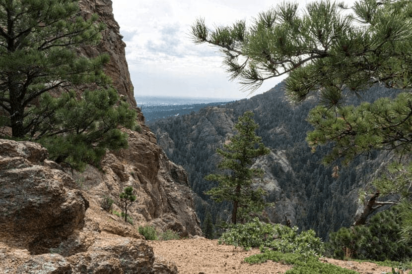
In North Cheyenne Canyon, Edward Payson Tenney built a cabin in 1881, and the original Bruin Inn in 1884. That building burned in 1958. A smaller structure was constructed in 1916 or 1917. It later became a curio shop. We lived up the mountain in the 1950s to the late1980s, and to us, the North Cheyenne Canyon seemed pretty touristy, with attractions like the Helen Hunt Falls, and the Bruin Inn, compared to the part of the South Cheyenne Canyon that we called home.
Beyond the Inn, you could ride the Gold Camp Road through old railroad tunnels up onto the Corley Road, then on to Victor and Cripple Creek. As a kid riding my horse, I can tell you I imagined or thought I heard the phantom sounds of a coach in one of the tunnels and the isolated whistles of an unseen train.

How many tunnels are on Gold Camp Road?
Many of the locals in the Colorado Springs area are familiar with the legends surrounding the arched Gold Camp rail tunnels. Originally there were nine of the passageways dug into the hills, but as railroad travel in the area dwindled, three of the tunnels succumbed to age and vandalism and collapsed.
It seemed to appear the first reasonable entry point for what is now called “Greenwood Park” (though we never heard, nor used that name when we lived there) would have been a southern tail of the Mt. Cutler Trail, which became important around 1884.
To the best of my memory, we accessed that piece of the trail from the Gold Camp Road after passing through the first tunnel. Two of the tunnels had collapsed in the 1980s blocking the lower portion of the Gold Camp Road, at one time the road was easily traveled.
Once travelers drop down into the Sweetwater Canyon, several large parcels are dividing the valley. One of the earliest settlers was Georgiana Russell, who immediately filed her claim for a 160-acre ranch in 1884. Her patent was issued in 1889, making her one of the first settlers, as far as I know.
That brave woman apparently moved out West for her health, which never completely improved. When she felt a little better, she returned to the East and promptly died. This happened long before the access road was built, so her egress probably would have been the Cutler Trail.
In 1888 Bertha E. Bourne homesteaded 160 acres and then received the patent for Greenwood Park; more as an investment opportunity, than for a permanent residence. Bertha later gave it to her daughter, who sold it to (a) Mr. McNulty.

Map Above by Eric Swab.
Two of his maps are included in this document but he says “he will be making corrections and send them to me later.” Yet this gives the general idea of some of the old cabins, some are not included. You can ask me if you wish, but they aren’t on pertinent acreage.
A Map and Look Today

About ten years later, Ms. Clara Cassatt homesteaded a 160-acre parcel in the gully to the North toward the Gold Camp Road. She received a patent to occupy on April 26, 1893. How it worked was that a person applied for a license, then occupied the land for 5 years, proving intention to settle, before receiving a patent.
Or, they could simply pay $1.25 an acre to receive the patent early. She chose that path. The canyons became full of such homesteads. Clara lived north of Bertha Bourne’s piece, so, they were neighbors connected by the Cutler Trail. Ms. Cassatt built two cabins from local trees, across from a gigantic, solitary boulder.
My friend, and historian, Eric Swab told me Clara parked her wagon to the side of the North Cheyenne Canyon Road. Trey Spiller, who currently lives in an improved version of our childhood home, told me Eric knows where that spot is, though it is meaningless to me. She removed the wheels when she parked. When she needed to go to town, she first had to re-install those wheels – every time – so her wagon wouldn’t be stolen.
Today Some As Can you drive Gold Camp Road to Cripple Creek?
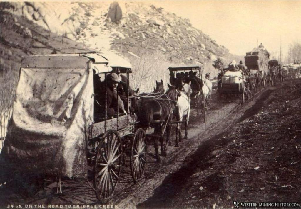
“This is not a challenging road, but it connects Colorado Springs to Cripple Creek and other great 4×4 roads on the way. It was initially a Ute Indian Trail and then a rail line. It features extensive views, especially in the fall when the aspens turn.
It beats me how any of those women hauled supplies in or out, using that trail! God bless them. Tough for me to believe that it was, at one time, the main thoroughfare since I found it to be such a weird little trail when I traveled it by horse in the 1960s. It was very easy to get off trail, and not even know it happened. I had to imagine where the path might have been, and zig zag across the gully to pick it up again.
It was tough going, and steep to climb up or down, near the Gold Camp Road. . .
People say there might be a sign there now, and many more hikers than in the mid-1900s.
That should help.
************
PART TWO Will Be Posted
Very Soon!
Author Diane Olsen

